Yukon? Where? location_on
One of three northern Canadian territories, the Yukon is situated in the northwest corner of Canada's continental mainland.
It is situated directly north of the Canadian province of British Columbia, to the east of Alaska and west of the Northwest Territories.
Its northern border touches the Arctic Ocean.
|
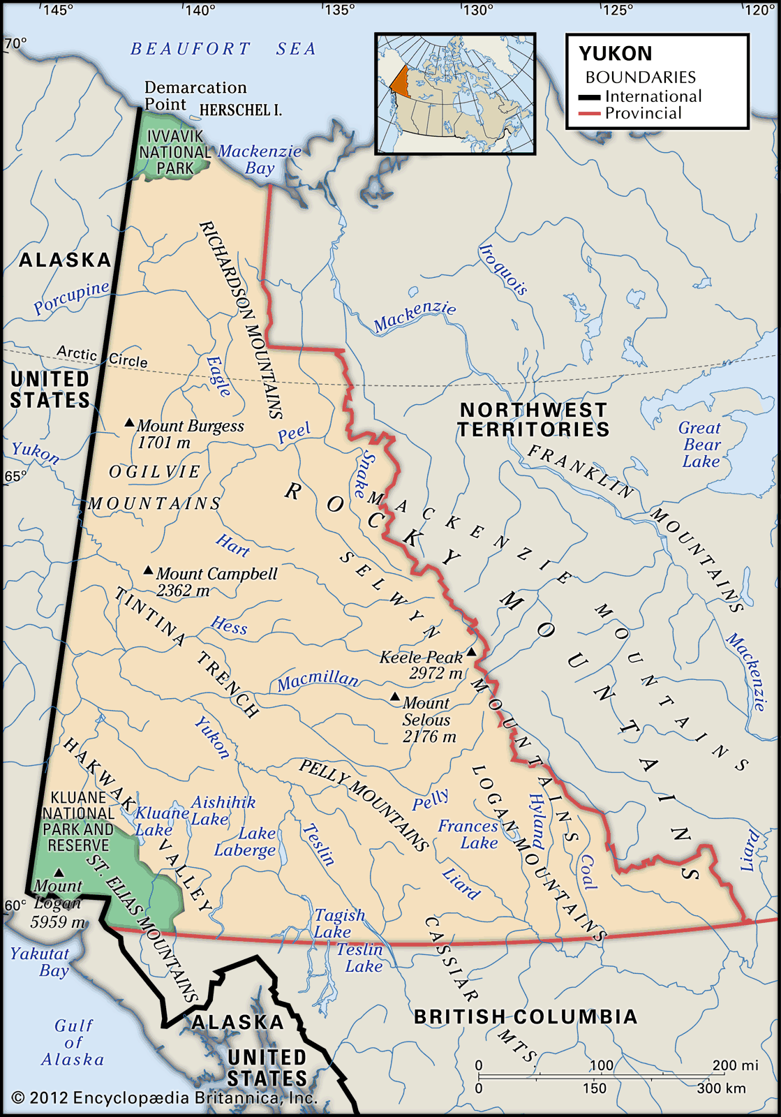
Physical features of Yukon - Image by Encyclopædia Britannica, Inc.
|
Google Maps map
The best time of year to visit Whitehorse* in Canada date_range
Here are some average weather facts we collected from our historical climate data:
- During the month of July you are most likely to experience good weather with pleasant average temperatures that fall between 20 degrees Celsius (68°F) and 25 degrees Celsius (77°F).
- Whitehorse has dry periods in February, March, April, May, November and December.
- The coldest season / winter is in the months of January, February, March, November and December.
- The warmest month is July with an average maximum temperature of 20°C (69°F).
- The coldest month is January with an average maximum temperature of -11°C (12°F).
- July is the most wet month. This month should be avoided if you are not a big fan of rain.
- April is the driest month.
- June is the most sunny month.
* Whitehorse is the capital and only city of Yukon, and the largest city in Northern Canada.
Source from https://weather-and-climate.com/average-monthly-Rainfall-Temperature-Sunshine-fahrenheit,whitehorse-yukon-ca,Canada
Weather averages in Yukon thermostat
| January |
February |
March |
April |
May |
June |
July |
August |
September |
October |
November |
December |
| 3.9 °C |
5.8 °C |
11.3 °C |
16.5 °C |
21.2 °C |
26.2 °C |
28.9 °C |
28.7 °C |
24 °C |
17.3 °C |
10.7 °C |
4.7 °C |